See also Empires and Cities individual sections.
General
Blueletter Bible Map - Illustrations Menu
Bible Maps - The Interactive Bible (Black and White High Res)
Bodleian Library Map Room
Cartographic Images
Harvard Map Collection
Historical Map Web Sites -The Perry-Castañeda Library Map Collection The University of Texas at Austin
John R. Borchert Map Collection (University of Minnesota)
John R. Borchert Map Libraries (University of Minnesota)
The Map Collection at Yale
Mercator's World HomePage (a magazine devoted to cartography)
Oddens's Bookmarks
Oddens's Bookmarks : Maps and Atlases
Maps of the Middle East
CIA Atlas of the Middle East
CIA Map of the Middle East
Jerusalem in Old Maps and Views An exhibit from the Israeli Ministry of Foreign Affairs
Medeba Map (Israeli Ministry of Foreign Affairs exhibit on Jerusalem in Early Christian Times)
Clickable Map of Cairo
Maps of Africa
Microsoft Terraserver Satellite Images of the world, including major cities of the Middle East
World City Maps
World Map and more maps
Virtual Tourist Middle East Map | World Map
Celts
Map of Celtic Tribes Locations of 75 tribes in Britain and Gaul.
Egypt
Main Map of Ancient Egypt
Oriental Institute Map Series - Site Maps Archaeological sites, modern cities, and rivers in Egypt, Iran, Iraq, Levant, Sudan, Syria, and Turkey.
Theban Mapping Project Valley of the Kings. Lots of maps, a timeline, hieroglyphs, photos and more.
Greece
Ancient Greece Map of Ancient Greece and an ancient map of Greece.
Ancient Asia Minor from an 1849 atlas by Alexander G. Findlay.
Athenian League Map of the Athenian League and the Peloponnesian war in 435 BC.
Classical Atlas Project Clickable map.
Cultural Map of Hellas Clickable map of Greece. Includes regions and their names.
Cyclades Islands Map showing the Aegean Islands and information on the Cycladic civilization (3000-1000 BC).
De Kaart De Moderne Kaart and De Oude Kaart show the differences between ancient and modern Greece.
Four frames of the Greek World The world according to Homer, Hecateus, Eratosthenes, and Ptolemy.
Greece in the Archaic Age Map of the political structure from 750-490 BC. Includes Phrygia, Caria, and Lydia and other areas.
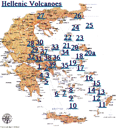
Hellenic Volcanoes Modern map of Hellas (Greece) with 39 volcanoes marked.
Herodotus' Map Reconstruction of Herodotus World Map (450 BC) showing Asia and Europe with the seas surrounding them.
IAM Map Index Interactive Ancient Mediterranean's PDF relief maps for download.
Late Aegean Bronze Age Cities and palaces (1250-1000 BC).
Locator Maps for Myth and Greek Tragedy Separate maps for Athens, Aulis, Eleusis, Marathon, Mediterranean Region, Megara, Phrygia, Plataea, Salamis, Sparta, Tenedos, Thebes, Thespiae, Trachis, and Troy.
Map of Attica Small map of Attica, Boeotia, and Euboea with their cities.
Map of Sparta Detailed map showing the areas of Elis, Achaea, Arcadia, Argolis, Laconia, Boeotia, and Attica.
Maps of Greece Three maps of Greece; The Mediterranean and closeups of Greece and Crete.
Returns of the Achaean Leaders Routes taken home by the Greek leaders after the Fall of Troy.
Greek culture in Minor Asia after 3rd century B.C.
Clickable map of Asia Minor with historical info on the different geographic areas.
Maya
Maya Maps
Annotated map explaining importance of the major cities.
Near East
Ancient Jerusalem A city map showing elevations, landmarks, modern and ancient walls.
Ancient Near East Empires from 700-300 BCE Assyrian, Babylonian, Persian, and Macedonian empires.
Ancient Mesopotamia Map of Akkad, Babylonia, Assyria, and Sumer. Major cities and other rivers included.
The Assyrians Map showing the empire from 1800-1600, 1244-1208, and 699-627 BC; includes cities and rivers.
City of Nippur Maproom Nippur as the center of Sumer and Akkad. Archaeologist John Peters and his excavation in 1888.
The Earliest Known Map Monograph of a clay Babylonian map from 6200 BC. Early map making. Includes bibliography.
Inscriptions of the Land of Israel
Map of Israel marking the spots where ancient inscriptions have been found. Clicking on red cities takes you to more detailed maps.
Map of Mesopotamia Small color map of cities including Babylon, Ur, Akkad, and Asshur. Map of Sumerian Archaeological Sites Map of ancient caravan routes and sites of Kermanshah (7500-5600 BC), Samarra (5700-4900 BC), and Early Ubaid (5200-4500 BC).Nippur, Sacred City of Enlil B&W map of rivers and cities from the Khabur to the Karkeh River and from Khorsbad to Eridu, Susa to Mari.
Nippur Map Room Two maps of Nippur.
Political Change in Ancient Mesopotamia 3000-1000 BCE Interactive map using shockwave to show successive political waves from Sumerian to Kassite with Babylonian, Assyrian, and Agade approaching.
Sumer Map showing areas and time periods for Sumer, Akkadian Empire, and the Old Kingdom of Egypt.
Phoenicia
Phoenician Colonies Map shows the spread of the Phoenicians around the Mediterranean, North Africa, and Spain.
Rome
Atlas Historique Périodique Maps from 1-900 AD showing political boundary changes for each century.
Central Italy 4th Cent. AD drawing showing structures and roadways of Central Italy from the 393 AD Peutingerian Tables.
Clickable map of Ancient Rome Roman Empire about 120 AD focusing on the 54 provinces.
Clickable Map of the Roman Forum Photographs and information about twenty-three edifices from the forum, including schematic of each location.
Etruscan League Map of Italy showing the area of the Etruscan League in 530 BC. Geography of Roman Gaul 1,500 sites and peoples relating to Gaul. Ancient placenames and modern archaeological sites (including villas, cemeteries, aqueducts, etc.).
Irlande, Bretagne et Frise Map of the western portion of the Roman Empire in 380, 420, 460, and 540 AD with detailed legend.
Lacus Curtius Atlas
Language Map of Ancient Italy Shows where in Italy: Gaulish, Greek, Oscan, Ligurian, Messapic, Etruscan, Umbrian were spoken.
Map of Ancient Rome 117 AD, from ThinkQuest.
Map of Rome Drawing showing the architecture.
Map of Tuscany Modern map of Tuscany in detail.
Maps and Codices of the Roman Empire Detailed Maps of Forum Romanum, Campus Martius, environs of the Urbs, and more.
The Roman Empire Map of the Roman Empire at its largest extent.
Roman Italy: Urbanization and Roads
Ever wonder where the vaunted Roman roads were or when they were built? This interactive map shows the progress from 300-1 BC.
Second Punic War Interactive map site showing locations and routes of 4 phases of the fighting. Uses Shockwave.
Tabula Peutingeriana Monograph on 1st C AD cartogram by Castorius showing roadways of the Roman empire.
Trade Routes and Great Empires of the First Century AD Silk, horses, slaves, grain, myrrh and other products traded across the known world.
Map of the Underworld Map and summary showing the mythical passages of Odysseus and Aeneas in the Underworld.
Cartographic Resources on the Net
General Map History Homepage
Oddens' Bookmarks
MapHist ( E-mail Discussion Group )
Mercator's World - The Magazine of Maps, Exploration and Discovery