Series of N.T. Color Maps for the Study of the Word of God
Map of the World of the New Testament - This map reveals the "Nations" within the ancient world during the first century A.D., the time of the New Testament. The map includes the areas of Israel, Asia, Greece, and Italy.
Map of the Roman Empire (14 A.D.) - This map reveals the Roman Empire during the time shortly after the birth of Jesus, in 14 AD at the time of the death of Augustus. The order which prevailed in this extensive empire, the good military roads, and the use of Koine Greek as the general language of culture throughout the area were among the factors which multiplied the rapid spread of the Gospel of Jesus Christ. (Color Map)
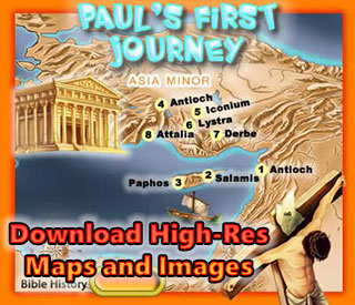
Map of Paul's First Missionary Journey (48 A.D.) - This map reveals the areas in Asia Minor where Paul visited in his first missionary journey. Around 48 AD, in the springtime, Paul and his companions Barnabas and Mark were sent on a mission from the church in Antioch. This would be the first of Paul's Missionary Journey's. (Color Map)
Map of Paul's Second Missionary Journey (51 A.D.) - This map reveals the areas in Asia and Greece where Paul visited in his second missionary journey. Paul re-visits a couple cities in Asia, one of which was Lystra where he was stoned and left for dead a few years earlier. He later has a vision that leads him over to Greece and Paul and his companions travel and minister in various cities in Greece (Philippi, Thessalonica, Berea, Athens and Corinth. Later Paul returns to Ephesus and finally to Caesarea and Antioch. (Color Map)
Map of Paul's Third Missionary Journey (54 A.D.) - This map reveals the areas in Asia and Greece where Paul visited in his third missionary journey. On Paul's third missionary journey he returned to the cities he had first visited on his first missionary journey. During this time he decided to remain in Ephesus for about 3 years, and this city was the main focus of his activities and an important Christian community (Acts 19). (Color Map)
Map of Paul's Voyage to Rome (61 A.D.) - This map reveals the journey of the Apostle Paul to Rome in 61 AD. Paul had appealed to Caesar in Caesarea (Acts 24-25), his goal was to spread the Gospel of Jesus throughout the Roman Empire all the way to her great capital, Rome. He demanded that his case be heard by the Roman Emperor. According to the Book of Acts, after his shipwreck on the Island of Malta (Acts 28) he came to Italy and was put on house arrest for two years (Acts 28:30). (Color Map)
Map of the New Testament World - This map reveals the "Nations" within the ancient world during the first century A.D., the time of the New Testament. The map includes the areas of Israel, Asia, Greece, and Italy. (Color Map)
Map of New Testament Asia - This map shows the cities within Asia Minor during the first century A.D., the time of the New Testament. The map includes the principal cities of Asia including Tarsus, Ephesus, and Colossae, and provinces like Galatia and Pamphilia. (Color Map)
Map of New Testament Greece This map reveals the cities within Greece in the ancient world during the first century A.D.,The map includes the principal cities of Greece like: Athens, Corinth, and Thessalonica, and provinces like Macedonia and Achaia. (Color Map)
Map of New Testament Italy - This map reveals the cities within Italy during the first century A.D., the time of the New Testament. The map includes the principle cities of Italy like Neapolis and Rome. Follow the path of the Apostle Paul. (Color Map)
Map of the Roads in Israel - This map reveals the major and minor roads and highways, and the Roman Legionary Camps in the land of Israel during the first century AD. The Via Maris, the King's Highway, the Way of the Sea, and other small roads can be seen on this map. (Color Map)
(More to Come)

