Maps are essential for any serious Bible study, they help students of the Scriptures understand the geographical locations and historical backgrounds of the places mentioned in the Bible. Our collection of maps are simple and they are free.
Maps are great for studying and illustrating the geographical terrain of the ancient world. From the Life of Jesus to the Journeys of Paul and the Apostles these maps are a blessing for the serious student of the Scriptures. Without a terrain map it is hard to discover some of the fabulous topography of Biblical places. For example in Israel the Dead Sea region is the deepest land trench in the entire world. To travel from Jerusalem to Jericho was quite a descent into that region. Jerusalem was 2500 ft above sea level and Jericho was 850 feet below sea level and the distance was about 23 miles. This made it almost a vertical descent.
Luke 10:30 "And Jesus answering said, A certain man went down from Jerusalem to Jericho, and fell among thieves, which stripped him of his raiment, and wounded him, and departed, leaving him half dead."
God is the author of geography and because He knows the end from the beginning He used geography to help form the great kingdoms of the ancient world. He set mountains in strategic locations to halt prideful man from conquering certain places too easily.
Old Testament Maps - Collection of maps about people, places, and events in the Old Testament from the beginning of civilization and the patriarchs of the Bible, to the times of Nehemiah and Ezra.
New Testament Maps - Biblical collection of maps relating to the people, places, and events recorded in the New Testament from the time of Herod the Great and the birth of Jesus, to the Book of Acts and the journeys of the Apostle Paul to the churches in the Book of Revelation and the destruction of Jerusalem in 70 AD.
Book by Book Bible Maps - These Quick Reference Bible Maps provide a range of geographical maps and illustrations for each Book of the Bible in a fast, simple, and easy to read format. The period of Biblical history ranges from the beginning of creation in Genesis through the history of Israel and to the journeys of the Apostle Paul and the Book of Revelation.
Map of the World of the Old Testament - Map revealing the primary geographical locations in the ancient Near East during Old Testament times. (Color Map)
Map of the World of Abraham - This Bible map shows the world at the time of Abram, the first Hebrew and the father of the Jewish race. (Color Map)
Map of the Journeys of Abraham - This map reveals the journeys of Abraham from Ur of the Chaldees to the land of Canaan and the 17 locations he visited according to the Bible. (Color Map)
Map of the Journeys of Isaac - Bible map of Isaac's journeys in the land of Canaan and the 10 key locations that he visited. (Color Map)
Map of the Journeys of Jacob - Color map of Jacob's journeys throughout the land of ancient Canaan and the 14 key locations that he visited. (Color Map)
(More to Come)
Old Testament Color Maps
Map of the Ancient Fertile Crescent (2500 B.C.) - Sometime around 2500 B.C. a great migration developed upon what is known as the "Fertile Crescent," which was like a great arc of cultivable land that extended from the Persian gulf, up and around Mesopotamia and back down to Israel and Egypt. (Color Map)
Map of Israel and her Neighbors (2000 B.C.) - Map of the ancient world at the time when the Amorites came and conquered every kingdom around the western Near East. They built new cities which later became the Canaanite cities of the Bible. (Color Map)
Map of the Egyptian Empire (1450 B.C.) - This map reveals the Egyptian Empire at the time of the Conquest of Canaan by Thutmose III (1450 B.C.). The18th dynasty was established in Egypt during the middle of the 16th century B.C. by Ahmose (Aahmes). At this time Egypt's New Kingdom took complete control over the land of Canaan, the kingdom lasted over 400 years. (Color Map)
Map of Old Testament Israel (900 B.C.) - This map shows the land of Israel after David and Solomon. There are numerous cities mentioned in the Old Testament which have now been verified by history. (Color Map)
Map of the Assyrian Empire (650 B.C.) - This map reveals the Assyrian Empire at the time of Ashurbanipal who conquered kingdoms all the way to Thebes in Egypt. The map shows how vast the Assyrian Empires territory had extended, which covered lands from the Persian Gulf to Egypt to present day Turkey. (Color Map)
Map of the Babylonian Empire (550 B.C.) - This map reveals the boundaries of the Babylonian Empire 30 years after the destruction of the Temple in Jerusalem by Nebuchadnezzar. He captured major cities like the Phoenician city of Tyre and he also drove out the Egyptians from Syria and Phoenicia which enabled him to secure a rich trade gateway to the Mediterranean Sea. (Color Map)
Map of the Persian Empire (550 - 486 B.C.) - This map reveals the expansion of the Persian Empire from Cyrus the Great to Darius I, 550-486 BC. The Persian Achaemenid Empire was actually the last great empire of the ancient Near East. Its boundaries extended from the Aegean Sea in the west to the Indus River in the east, such a large empire was created in just a little over 10 years by Cyrus II the Great. (Color Map)
Map of Ancient Mesopotamia - This map reveals the geographical areas in Ancient Mesopotamia from Babylonia to Akkad, to Sumer, to Assyria, and cities like isin, Ur, Larsa and Nineveh in the north. Most scholars date the beginning of Babylonia to the fall of the third dynasty of Ur, around 2000 BC. (Color Map)
Map of Ancient Trade Routes From Mesopotamia - This map reveals the trade routes from ancient Mesopotamia to Egypt and the Mediterranean world. The underlined cites were important trade centers. (Color Map)
Map of the Campaigns of Alexander the Great - Alexander III "the Great" became one of the greatest military commanders in all of history. His major battles are marked on the map by the fiery sun symbol. Alexander conquered the vast Persian Empire which had swallowed up the territories of earlier empires: the Egyptian, Assyrian, and Babylonian. He ruled from Greece to India, and suddenly died in Babylon. (Color Map)
Map of the Donations of Alexandria (34 B.C.) - This map reveals the Roman provinces belonging to Marc Antony, Italy and the Roman provinces belonging to Octavian, the territories belonging to Cleopatra's children, and the boundary between Antony and Octavian. (Color Map)
New Testament Color Maps
Map of the Roman Empire (14 A.D.) - This map reveals the Roman Empire during the time shortly after the birth of Jesus, in 14 AD at the time of the death of Augustus. The order which prevailed in this extensive empire, the good military roads, and the use of Koine Greek as the general language of culture throughout the area were among the factors which multiplied the rapid spread of the Gospel of Jesus Christ. (Color Map)
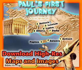
Map of Paul's First Missionary Journey (48 A.D.) - This map reveals the areas in Asia Minor where Paul visited in his first missionary journey. Around 48 AD, in the springtime, Paul and his companions Barnabas and Mark were sent on a mission from the church in Antioch. This would be the first of Paul's Missionary Journey's. (Color Map)
Map of Paul's Second Missionary Journey (51 A.D.) - This map reveals the areas in Asia and Greece where Paul visited in his second missionary journey. Paul re-visits a couple cities in Asia, one of which was Lystra where he was stoned and left for dead a few years earlier. He later has a vision that leads him over to Greece and Paul and his companions travel and minister in various cities in Greece (Philippi, Thessalonica, Berea, Athens and Corinth. Later Paul returns to Ephesus and finally to Caesarea and Antioch. (Color Map)
Map of Paul's Third Missionary Journey (54 A.D.) - This map reveals the areas in Asia and Greece where Paul visited in his third missionary journey. On Paul's third missionary journey he returned to the cities he had first visited on his first missionary journey. During this time he decided to remain in Ephesus for about 3 years, and this city was the main focus of his activities and an important Christian community (Acts 19). (Color Map)
Map of Paul's Voyage to Rome (61 A.D.) - This map reveals the journey of the Apostle Paul to Rome in 61 AD. Paul had appealed to Caesar in Caesarea (Acts 24-25), his goal was to spread the Gospel of Jesus throughout the Roman Empire all the way to her great capital, Rome. He demanded that his case be heard by the Roman Emperor. According to the Book of Acts, after his shipwreck on the Island of Malta (Acts 28) he came to Italy and was put on house arrest for two years (Acts 28:30). (Color Map)
Map of the New Testament World - This map reveals the "Nations" within the ancient world during the first century A.D., the time of the New Testament. The map includes the areas of Israel, Asia, Greece, and Italy. (Color Map)
Map of New Testament Asia - This map shows the cities within Asia Minor during the first century A.D., the time of the New Testament. The map includes the principal cities of Asia including Tarsus, Ephesus, and Colossae, and provinces like Galatia and Pamphilia. (Color Map)
Map of New Testament Greece This map reveals the cities within Greece in the ancient world during the first century A.D.,The map includes the principal cities of Greece like: Athens, Corinth, and Thessalonica, and provinces like Macedonia and Achaia. (Color Map)
Map of New Testament Italy - This map reveals the cities within Italy during the first century A.D., the time of the New Testament. The map includes the principle cities of Italy like Neapolis and Rome. Follow the path of the Apostle Paul. (Color Map)
Map of the Roads in Israel - This map reveals the major and minor roads and highways, and the Roman Legionary Camps in the land of Israel during the first century AD. The Via Maris, the King's Highway, the Way of the Sea, and other small roads can be seen on this map. (Color Map)
Map of the Physical Features of Ancient Israel - This map includes some of the geographical features of the land of Israel including: the Valley of Jezreel, Plain of Sharon, Coastal Plain, Central Hills, Jordan Valley, Plain of Philistia, Shephelah, The Negev, Wilderness of Judah, and Transjordanian Highlands. These physical features make up the country of of Israel. (Black and White Map)
Map of Ancient Israel's Bodies of Water - Map of the Rivers, Lakes and Seas in Ancient Israel. The rivers and streams from north to south are: Leontes, Qishon, Yarmuk, Jordan, Far'a, Jabbok, Kanah, Aijalon, Qilt, Sorek, es-Sant, Zephathah, Arnon, Sayyal, and Ghazzeh. The Lakes and Seas are: Mediterranean, Lake Hula, Sea of Galilee, and the Dead Sea. (Color Map)
Map of Ancient Israel's Natural Divisions - The land of Israel can be divided into four main geographical regions: The Coastal Plain, the Hill Country, The Great Rift of the Jordan Valley, The Transjordan Highlands. First is the Coastal Plain is filled with sand dunes and fertile alluvial soil. Second is the Hill Country is like a staircase of high hills in the north and smaller hills in the south Third is the Great Rift of the Jordan Valley which is a deep land trench 1500 feet below sea level. Fourth is the Transjordan Highlands which is a high plateau range about 4,000 feet above sea level which descends east into the Syrian-Arabian Desert. (Color Map)
Mount Ararat Comparison - Topographical illustration of Mount Ararat compared to other mountains. Mount Ararat is where Noah's Ark came to rest (Gen 8:4). This illustration reveals Mount Ararat (16,873 feet above sea level) in comparison to other mountains mentioned in the Bible. (Color Map)
1949 Map of Israel with Boundaries - When the new state of Israel flag was raised the Arabs rallied an attack outnumbering the Jews 100-1 in people, 40-1 in troops, 1,000-1 in military equipment, and 5,000-1 in land. When Britain left Israel the Jews were on their own with 1 rifle to every 5 soldiers and no artillery. Palestinian guerillas were nearby when they heard the news, they organized along with Egypt, Jordan, Syria, Lebanon, and Saudi Arabia. Their ultimate goal was the extermination of every Jew in the world. The Arab general proclaimed, "This will be a war of extermination and a momentous massacre which will be spoken of like the Mongolian massacres and the Crusades." The world was watching and were astonished to see the Jews winning on every front and the Arabs retreating. (Color Map)
Map of the Profile of the Jordan - Map of the Jordan River with Hills and Cross Section (side view). This profile of the Jordan River between the Sea of Galilee and the Dead Sea compares various mountains, hills, and valleys in the land of Israel with the sea level. (Color Map)
Map of Israel in New Testament Times - Political map of Israel during New Testament times, when Pontius Pilate was procurator of Judea and Herod was Tetrarch of Galilee (Luke 3:1). The primary locations mentioned in the New Testament are listed; the roads are also listed on the map, although many roads were not always safe to travel. (Color Map)
Map of Jerusalem - This map includes the area of Jerusalem with a comparison of ancient and modern times. Jerusalem was an impressive city in ancient times, especially in the time of Herod the Great. This map shows Jerusalem in modern times with the Upper City and Lower City. (Black and White Map)
Map of Lower Galilee - This map includes some of the geographical locations within the ancient Galilee region in Israel. Lower Galilee contained many hills about 2000 feet above sea level, not as large as the northern Galilee region. It comes down like a staircase of large to smaller hills. The valley formed an easy path to the Sea of Galilee, especially to the north side of the Sea where Capernaum was located. (Color Map)
Map of Upper Galilee - This map includes some of the geographical locations within the ancient Galilee region in Israel. According to Josephus, Galilee was divided naturally into two regions divided by a very steep 2000 foot slope. (Color Map)
Map of Samaria - This map includes some of the geographical locations within the ancient Hill Country region in Israel. According to Josephus, on the north the Hill Country descends to a very steep 2000 foot slope into the Valley in the Upper Galilee region. The Hill Country was filled with mountains and was divided into four parts: Upper and Lower Galilee, the Hill Country of Samaria, and the Hill Country of Judah. The south end sloped into the Negev region. (Color Map)
Map of the Coastal Plain of Israel (Northern) - Israel and Judah both had the privilege of sharing the Coastal Plain also known as the Maritime Plain. The Northern Coastal Plain ran from the Ladder of Tyre down to Joppa as seen in the map above, although the entire Coastal plain ran south to the River of Egypt (Wadi el-Arish), the distance was about 150 miles and the width varied from 3 miles in the north to 25 miles in the south. (Color Map)
Map of the Coastal Plain of Israel (Southern) - Israel and Judah both had the privilege of sharing the Coastal Plain also known as the Maritime Plain. The Southern Coastal Plain known as the Plain of Philistia ran from the Joppa to the river below Gaza called the River of Egypt (Wadi el-Arish) as seen in the map above. (Color Map)
Map of the Northern Negev - The Negev was referred to as the "dry land," and it was south below the hills of Judah. Israel was often referred to as extending from Dan in the north to Beersheba in the south. Beersheba was in the heart of the Negev, and the Negev extends 15 mile to the north and south of Beersheba, and 40 miles from east to west. (Color Map)
Map of Israel - Judea - Judah was the southern part of the Country of Israel, when King Solomon died the kingdom was divided into two parts, "Israel" and "Judah" and the southern part of Israel became Judah. According to Scripture it went from Jaba (Geba) in the North to Beersheba in the South and Jerusalem was part of Judah. The Hebrews from Judah were referred to as Jews (Judahites) and their land was known in Greeks and Latin as "Judea." (Color Map)
Map of the Decapolis and its Cities - The Decapolis was an alliance of ten cities, originally Palestinian. All but one (Scythopolis) were on the east side of the Jordan. In New Testament times these cities were most definitely Greek in character and under the protection of Rome (Governor of Syria). (Color Map)
Map of the Edomite Territory - The Edomites were the descendants of Esau (Gen 25:25; 36:1) and lived in strong mountain fortresses. They became prosperous through agriculture, cattle, and the tribute they levied on passing caravans. (Color Map)
Map of Galilee and Northern Israel - This map includes some of the geographical locations within the ancient Galilee region in Israel. Galilee and its surrounding territory (Northern Palestine). The names that are underlined are from the Old Testament period, the others are important in New Testament times. Galilee was in the Roman province of Judea. (Color Map)
Map of Judea and Southern Israel - Judea and the surrounding territories (Southern Israel). Many of the cities in this map are known from the Old Testament period. Most were important in New Testament times. (Color Map)
Map of Samaria and Central Israel - Samaria (Central Israel) in New Testament times. The names that are underlined were important in Old Testament times. (Color Map)
Map of Jerusalem in New Testament Times - The solid lines indicates the probable site of walls and buildings that are no longer there. The dashed lines represents the present wall of the old town and the railroad tracks indicate the probable course of the main access roads. Also see below a cross section of the modern city of Jerusalem as seen from the south, with some Biblical locations. (Black and White Map)
Jerusalem Cross Section - The modern city of Jerusalem as seen from the south, with some Biblical locations. Click here to see a map of Jerusalem in the First Century AD. (Black and White Map)
Map of Asia - In New Testament times Asia referred to a Roman province located at the western part of what came to be known as Asia Minor. Asia Minor was the area between the Black Sea, Aegean Sea, and the Mediterranean Sea. The provinces seen in the above map include: Asia, Bythinia and Pontus, Galatia, Pamphylia, Lycia, Cilicia, and Commagene. (Color Map)
Map of Achaia - Achaia was a region of Greece on the north coast of the Peloponnesus. The topography of Achaia was filled with mountains and therefore was difficult to travel through and this was one of the reasons why ancient Greece was difficult to unify. The geography of Greece forced most of the population to dwell in the beautiful sea ports and thus spread their culture throughout the Mediterranean. Achaia was a Roman Province in New Testament times. Paul spent much time there and expressed his love toward the churches in Achaia, and commended them for their liberal giving. (Color Map)
Map of Adriatic Sea - Paul journeyed on this sea on his way to Rome and was met with a violent storm which caused him and his crew to be shipwrecked on the island of Malta (Acts 27:27). The Adriatic Sea or known as the Sea of Adrias in New Testament times was located between Italy on the West and Dalmatia, Macedonia and Achaia on the East, and on the South it extended into the central part of the Mediterranean Sea between the islands of Crete and Malta. Ptolemy described the Adria in his writings and Josephus mentioned that it was in this sea that he was rescued by a ship of Cyrene. (Color Map)
Map of Asia in Roman Times - Map of Asia Minor and the adjacent Mediterranean lands in Roman times. Asia was a term which in the books of the Maccabees actually means Asia Minor, which Antioch III (the Great) had to give up to the Roman province of Asia Proconsularis (formed after 133 B.C.), which embraced the regions of Mysia, Lydia, Caria, and Phrygia. (Color Map)
Map of the 7 Churches of Revelation (Asia Minor) - Position of the seven churches in Asia Minor to whom the seven epistles in Revelation 1-3 were addressed: Ephesus, Smyrna, Pergamum, Thyatira, Sardis, Philadelphia, Laodicea. (Color Map)
Boundaries and Provinces of the Roman Empire In the Time of Jesus - The Boundaries of the Roman Empire were: North: The British Channel, the Rhine, the Danube, and the Black Sea. South: The deserts of Africa, the cataracts of the Nile, & the Arabian deserts. East: The Euphrates. West: The Atlantic. (Color Map)
Map of Paul's Missionary Journeys - The missionary voyages of the apostle Paul from Jerusalem to Rome. This map also shows much of the Roman Empire in the time of Paul and his journeys. Roman law and order, good military roads, and the use of Koine Greek as the general language of culture throughout the area were among the factors which multiplied the rapid spread of the Gospel of Jesus Christ. (Black and White Map)
Map of the Ancient Territory of Israel - This map includes some of the geographical locations within the land of ancient Israel from Kadesh-Barnea in the south to Tyre and Sidon in the North. These cities and locations make up the country of ancient Israel. There are also many ancient roads including the King's Highway. (Color Map)
Map of Israel - Benjamin - This map includes the area of the tribe of Benjamin. It includes the area north of the hill country of Judah. It was a relatively small area, about 10 miles from north to south and notice that the city of Jerusalem is located within the boundaries of Benjamin. (Color Map)
Map of the Ancient Near East - This map includes some of the geographical locations within the ancient Biblical world. The British Museum describes the Ancient Near East as Mesopotamia, Iran, Anatolia, the Caucasus, the Levant, Egypt, and Arabia. In ancient times the Near East was never one huge homogeneous area but an assorted collection of changing cultures. (Color Map)
Map of Israel Samuels Circuit - This map Shows the places that the prophet Samuel visited "in circuit" year by year, as he judged Israel in ancient times. He went to Bethel, Gilgal, and Mizpeh and returned to his home at Ramah where he built an altar to the Lord. (Black and White Map)
Map of Philistine Cities - This map shows the areas of expansion by the Philistines around the 10th century B.C. This was the time period when Saul had died and David began to reign in Israel. The Philistines were clearly superior in strength but the Lord promised that he would be with Israel. The Philistines expanded eastward toward Jerusalem but were stopped by King David and the armies of Israel. (Color Map)
Map of the Philistine Valley of Sorek - This map shows the Valley of Sorek in Ancient Philistia. The Bible says that Samson fell in love with a woman named Delilah in the Valley of "Sorek" a Hebrew word which means "Vine." It is not clear exactly where this valley was located but we know it was a valley which separated the Land of Judah from the Philistines. (Color Map)
Map of the Sinai Peninsula - This map illustrates the triangular Sinai Peninsula, which was known by the Egyptians as the Land of Fayrouz. It was a huge triangle of desert lying between the "arms" of the Red Sea, almost 20,000 square miles of wilderness. It is over 230 miles from the southern area between the arms to the Mediterranean Sea. (Black and White Map)
Map of Canaan - Twelve Tribe Portions - This map shows the Settlements of the Twelve Tribes of Israel. It took about 6 years for the tribes of Israel to conquer the Land of Canaan and to overcome the military might of the ancient Canaanites according to Joshua 14. It was at this time that Joshua divided the land among the tribes and allotted portions according to the Word of the Lord, the size of the tribe, and by casting lots. (Color Map)
Map of Ancient Egypt - Map of Egypt at the Time of the Exodus. During the time of Moses and the Exodus the land of Egypt was divided into Upper and Lower Egypt. Lower Egypt was the northern region closer to the Mediterranean Sea, the Nile Delta. (Color Map)
Map of The Amalekites Territory - Throughout Biblical history the Amalekites were bitter enemies of the Israelites. They were the first adversaries that the Israelites encountered after crossing the Red Sea. According to archaeology the Amalekites disappeared from history after the northern kingdom of Judah conquered the Negev territory in the 10th century B.C. (Color Map)
Map of The Ammonites Territory - The Ammonites (sons of Ammon) according to the Bible originated because of an incestuous relationship between Lot (Abraham's nephew) and his younger daughter (Gen 19:38). Archaeology reveals that the Ammonites dwelt east of the Jordan River and settled there at the beginning of the 13th century B.C. (Color Map)
Map of Amorite Settlements - The Amorites dwelt in various locations within Canaan and east of the Jordan River during the 18th-17th centuries BC. They were an enemy of Israel. (Color Map)
Map of the Territory of Asher - This territory contained some of the richest soil in all of the country. Asher did not succeed in driving out the Canaanite inhabitants. Joshua also revealed that each individual tribe was responsible to subjugate their portion of land and remove the defeated people. Many of the tribes failed in this responsibility. (Color Map)
Map of Ancient Nubia - During the time of Moses and the Exodus the land of Egypt was divided into Upper and Lower Egypt. Lower Egypt was the northern region closer to the Mediterranean Sea, the Nile Delta. The land of Nubia was located in ancient Egypt at the first through sixth cataracts of the Nile River. (Color Map)
Map of Ancient Aram - Aram Damascus was the most important of the Aramean kingdoms in the 9th-8th centuries BC. The mountainous area of the Syrians was truly the "roof" of the region as the name "Aram' implies. The mountains of Lebanon extended for nearly a hundred miles. (Color Map)
Map of the Wanderings of the Patriarchs - This map shows the locations from Haran to Canaan where Abraham and his sons sojourned according to Genesis 12-50 in the Bible. (Black and White Map)
Map of Assyrian Expansion - In 854 Shalmanassar clashed with the allied armies of 11 kings, including king Ahab of Israel; in 732 Damascus was taken by Tiglath-pileser III; in 722 Samaria fell to Sargon II (II Kings 17:6); in 701 Jerusalem was besieged by Sennacherib (II Kings 19), he also destroyed Babylon in 689; in 670 the Assyrian king Essarhaddon conquered Egypt and defeated Tirhakah, king of Ethiopia (II Kings 19:9). (Color Map)
Map of the Canaanite Nations - Map of the Nations of Canaan Before the Israelite Invasion. The Old Testament mentions a lot about Canaan, the half of Palestine to the west of the Jordan. This name "Canaan" has been found in Egyptian inscriptions of the New Kingdom, and also in the Tell el-Amarna letters. The Canaanites mostly lived in the plains (the coastal strip and near the Jordan). (Color Map)
Map of the Nations Defeated by King David - David conquered Jerusalem from the Jebusites and made it his capital and center of worship. He expanded his kingdom by victories over the Philistines, Moabites, Ammonites, and Edomites. (Color Map)
Map of Egypt in Bible Times - During the time of Moses and the Exodus the land of Egypt was divided into Upper and Lower Egypt. Lower Egypt was the northern region closer to the Mediterranean Sea, the Nile Delta. The Nile Delta was a triangular area of marshland about 150 miles from north to south, from Memphis to the Mediterranean, and about 150 - 200 miles wide. Upper Egypt was a bit further south from Lower Egypt, starting at Memphis (bottom of the Nile Delta Triangle) and extended for about 600 miles down the Nile River Valley to Elephantine (Aswan). (Color Map)
Map of the Kingdom of Saul - King Saul went to war against surrounding nations, including the Ammonites, the Amalekites, and chiefly the Philistines who defeated him at Mount Gilboa. The main wars during Saul's reign were Moabite, Edomite, Syrian, Amalekite, Philistine, and the Valley of Elah where David fought Goliath. (Color Map)
Map of the Kingdom of David and Solomon - David extended his kingdom north, south, east, and west. He expanded his kingdom by victories over the Philistines, Moabites, Ammonites, and Edomites, and suppressed many rebellions. His son Solomon brought the Kingdom of Israel to its greatest extent and even became a world power comparable to Assyria and Egypt. Solomon made treaties with Egypt, Moab, Ammon, Edom, Sidon, and the Hittite nation. (Color Map)
Map of Canaan During Joshua's Time - It took about 6 years for the tribes of Israel to conquer the Land of Canaan and to overcome the military might of the ancient Canaanites according to Joshua 14. It was at this time that Joshua divided the land among the tribes and allotted portions according to the Word of the Lord, the size of the tribe, and by casting lots. (Color Map)
Map of the Period of the Judges and Places - This map reveals the locations that were associated with the Judges of ancient Israel. Barak, Deborah and Barak defeat Jabin and Sisera near the waters of Megiddo, Jephthah banished to the land of Tob, where he is recalled, defeats the Ammonites and on his return sacrifices his daughter. Kamon, the place where Jair was buried, Gideon drives out the Midianites and other invaders from the eastern desert. The region where Tola and Abdon lived, From this area was the history of Samson and the Philistines, Ehud drove the Moabites back and slew their king. (Black and White Map)
Map of Phoenicia in Biblical Times - The Phoenicians were the former inhabitants of the northern coastal plain between Carmel and the Amanus Mountains. The main cities were Tyre and Sidon. Phoenicia means the "Land of Palm Trees or Date-Palms." (Color Map)
Map of the Territory of the Philistines - This map shows the areas of the ancient Philistines around the 10th century B.C. This was the time period when Saul had died and David began to reign in Israel. The Philistines were clearly superior in strength but the Lord promised that he would be with Israel. The Philistines expanded eastward toward Jerusalem but were stopped by King David and the armies of Israel. (Color Map)
Map of the Ancient Near East - This map includes some of the geographical locations within the ancient Biblical world. The British Museum describes the Ancient Near East as Mesopotamia, Iran, Anatolia, the Caucasus, the Levant, Egypt, and Arabia. In ancient times the Near East was never one huge homogeneous area but an assorted collection of changing cultures. (Color Map)
Satellite Map of the Near East - Satellite map of the Near East in the Biblical World. Israel was originally ruled by Egypt, but in the time of the Kings new powers appeared, primarily from the Mesopotamian region. (Color Map)
Map of Judah and Israel During the Period of the Kings - When Solomon died a civil war broke out as Solomon's sons and generals fought for the throne. Rehoboam had his fathers blessing to be the new king, but Jeroboam had more military influence. In the end, Rehoboam took the southern half of the country and called it "Judah". Jeroboam took the northern half and kept the name Israel. Each claimed to be God's chosen king. (Color Map)
Ancient Empires
Map of the Egyptian Empire - 1450 BC. This map reveals the Egyptian Empire during the Eighteenth Dynasty of Egypt at its greatest extant around 1450 BC. Dynasty XVIII was a very interesting period because Egypt reached her greatest extant during this time which was approximately 1550 BC to 1290 BC. It is also the time period of Moses and the Hebrew Exodus from Egypt which took place around 1400 BC, although no one knows for certain.
Map of the Assyrian Empire - 671 BC. Map of the Assyrian Empire at its Greatest Extant (900-607 BC.) This map reveals the Assyrian Empire in 671 BC under its greatest rulers: Tiglath-Pileser III (745-727 BC), Sargon II (722-705 BC), Sennacherib (705-681 BC), Esarhaddon (680-669 BC), and Ashurbanipal (669-627 BC). After Ashurbanipal died in 627 BC the Assyrian Empire was doomed and it was not long before Babylon would set its sights for world domination.
Map of the Babylonian Empire - 580 BC. Map of the Babylonian Empire at its Greatest Extant (606-536 BC.) This map reveals the Babylonian Empire in 580 BC under its greatest ruler Nebuchadnezzar II. The kings of the Neo-Babylonian Empire were Nabu-apla-usur, Nabu-kudurri-usur II (Nebuchadnezzar II), Amel-Marduk, Neriglissar, Laba�i-Marduk, Nabonidus. Babylon was finally captured by the Medes and Persians under Cyrus as predicted by the prophet Daniel, and the Babylonian Empire came to an end in 536 BC.
Map of the Persian Empire - 490 BC. Map of the Persian Empire under Darius I the Great. The Persian Empire was founded by Cyrus in 536 BC, Persia succeeded the Babylonian Empire. The first king of the Persian Empire was Cyrus, who issued the famous decree for the Jews to return to their homeland to rebuild their Temple. Under Darius the second Temple of Zerubbabel was completed; and under Xerxes, or Ahasuerus, the events recorded in the Book of Esther in the Bible happened; under Artaxerxes the Jewish state was reformed by Ezra, and the walls of Jerusalem were rebuilt by Nehemiah. The capital of the Persian Empire was Shushan. The Empire lasted about 200 years, and came to an end in 330 BC.
Map of the Greek Empire - 323 BC. Map of the Grecian Empire under Alexander the Great. This map reveals the Greek Empire in 323 BC under its greatest ruler Alexander the Great. The Grecian, or Macedonian Empire, rose up by conquering the existing Persian Empire. Alexander the Great, quickly and powerfully conquered the Persians in a brilliant series of battles, and Greece became the masters of the Oriental World. Alexander died in 323 BC, and after his death his empire was divided into four Kingdoms.
Map of the Roman Empire - 116 AD. Map of the Roman Empire at the time of Trajan's death in 116 AD. The Roman Empire came after the Grecian Empire not only in the ancient Jewish prophecies, but in the actual unfolding of historical events. Rome was actually first a Republic and then an Empire, and when Rome reached the height of its prosperity, it became the greatest empire the world has ever known. This was not good for the Jews, In 63 BC the Roman General Pompey entered Jerusalem, and at this point the Roman Empire began to rule in Israel. Rome allowed the descendants of the Maccabean line to remain in power until 40 BC. when Rome chose Herod the Great, an Idumaean, to be king and they made the land of Israel a province of Rome. The Roman Empire was the most thoroughly organized of any empire in ancient history. The Roman Empire lasted until 476 AD when the city of Rome was attacked by barbarians from the north. The eastern portion, however, lasted much longer and remained powerful for centuries, and was finally extinguished in 1453, at the close of the middle ages.