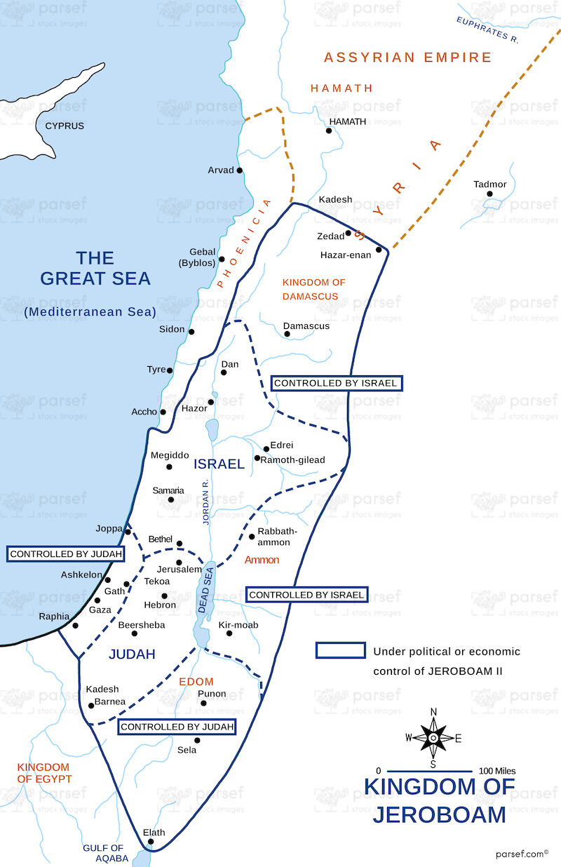
Kingdom of Jeroboam Map

Map of the Kingdom of Jeroboam
This map depicts the northern kingdom of Israel during the reign of Jeroboam I (c. 931 – 911 BCE), following the split from the united monarchy under Solomon. It likely encompasses the territories of the ten tribes that rebelled against Rehoboam, Solomon's son.
Possible inclusions:
- Tribal boundaries
- Major cities like Shechem (first capital) and Tirzah (later capital)
- Geographical features like the Jordan River and surrounding regions
Note: Due to the lack of detailed archaeological evidence, precise borders of the kingdom are uncertain.
