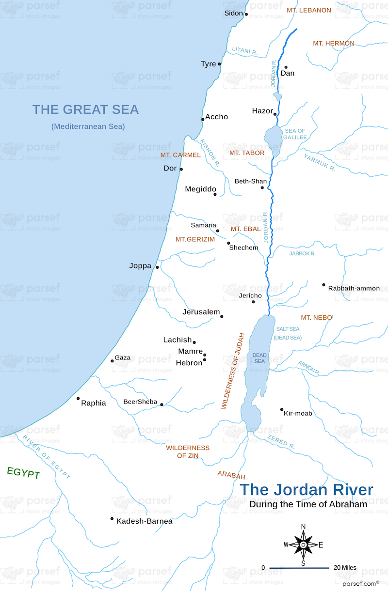
Jordan River During Abraham’s Time Map

This map depicts the Jordan River as it likely appeared during the time of Abraham, a key figure in the Hebrew Bible. The Jordan River is a vital freshwater source that runs north to south, and understanding its location is crucial for following Abraham's journeys.
The map likely focuses on:
- The Jordan River: The river's path would be prominently displayed, showing its course from the mountains to the Dead Sea.
- Possible Locations: Depending on the map's detail, it might pinpoint places Abraham visited near the Jordan, such as Haran or Canaan.
- Geographical Features: Surrounding features like the Sea of Galilee or the Dead Sea could be included for orientation.
This map aids comprehension of Abraham's travels and the geography of the region he encountered.
